How to Colour Country Groups and Alliances (EU, NATO, BRICS and More) in One Click
·3 min·View as Markdown
Written byJordan Hale — Writer, Oh My Maps!
Contents
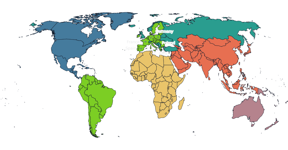
A map of “the EU” or “NATO members” is a common request and a tedious one to build by hand: click the wrong micro-state and the whole map reads as wrong. Oh My Maps! has a Groups control built for exactly this, on the world map and on two of the three country maps.
What a group actually does
Pick a colour, open Groups, choose one, and every country in it gets
painted at once. It counts as a single undo step: Ctrl+Z after applying the
European Union gives you back all 27 countries in one press, not one per
click. Groups use the same paint function as clicking a country by hand, so
you can still right-click any member afterward and change it individually.
The world map’s groups
Two kinds, both under the world map’s Groups control:
- The seven continents, Antarctica included.
- Six blocs: the European Union, NATO, BRICS, OPEC, ASEAN and Mercosur.
The bloc lists are maintained by hand and kept current, with the awkward cases resolved explicitly rather than left ambiguous: Angola has been out of OPEC since 2024, Saudi Arabia never formalised BRICS membership despite the 2023 invitation, Timor-Leste joined ASEAN in 2025, and Venezuela is currently suspended from Mercosur. If your definition of a bloc differs from the editor’s, applying the group and then clicking the two or three countries you disagree with is faster than building the map from nothing.
Try a bloc. Open the world map, pick a colour, and apply the European Union in one click.
Open the editorThe country maps: regions, not blocs
The two subdivided country maps have their own groups, built from the official statistical divisions rather than political alliances:
- Brazil offers the five IBGE regions: North, Northeast, Central-West, Southeast and South. They cover the 27 federative units exactly once, so colouring each region a different colour is five clicks with no gaps and no overlaps. Full walkthrough in How to make a map of Brazil’s states.
- The United States offers the four Census Bureau regions: Northeast, Midwest, South and West. These are the official definitions, not a colloquial sense of the words: Delaware, Maryland and DC are in the South, and Missouri is in the Midwest. Full walkthrough in How to make a US election map.
Europe does not have a Groups control yet
The Europe map has no group presets: no EU, no eurozone, no Schengen, no Nordics button. If what you actually want is “the EU in one colour”, the faster route today is the world map: apply the European Union group there, zoom into Europe, and export the current view rather than the whole map. You lose the tighter Europe-only framing and save clicking 26 countries by hand.
Combine a group with your own edits
Groups are a starting point, not a final answer. A common pattern: apply a continent, then use a second colour and Shift+click to sweep across a sub-region within it, then right-click the two or three outliers to fix them individually. Because each of those is its own undo step, you can back out any single decision without losing the rest of the map.
Next steps
- The full tour of the editor covers painting, patterns, labels and export in one pass.
- A map of Brazil’s states and a US election map go deeper on the two maps with their own regional groups.
Ready to make yours? Oh My Maps! is free, runs in the browser and needs no sign-up. Your map is saved locally as you work, and exports carry no watermark.
Open the editor