How to Make a Map of Countries You've Visited
·6 min·View as Markdown
TagsTravel MapsWorld MapMap Projections
Written byJordan Hale — Writer, Oh My Maps!
Contents
A visited-countries map is the most common reason people go looking for a map editor, and it is also the one that most tools handle badly, either by demanding an account before you can click anything, or by stamping a watermark across the thing you wanted to print.
Here is the whole workflow in Oh My Maps!, which is free, needs no sign-up, and never sends your map anywhere.
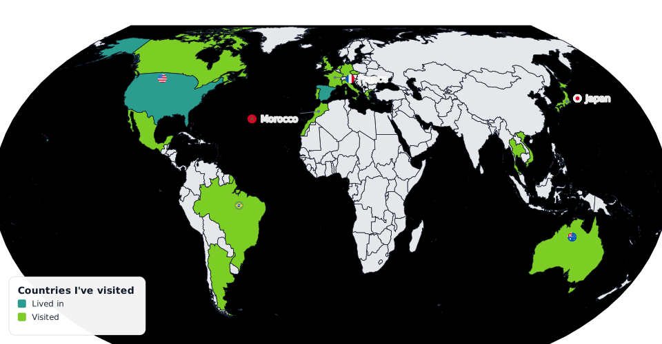
Decide what “visited” means before you start
This sounds like overthinking and it is not: the argument about layovers is the only genuinely hard part of a travel map. Pick a rule now and the rest is clicking.
Most people end up with two or three tiers. A workable set:
- Lived in: months, not days.
- Visited: left the airport, spent at least a night.
- Transited: connected through, or crossed a border and came back.
Two tiers is fine. Four is usually one too many to read at a glance. Whatever you choose, one colour per tier, and write the tiers down: they become your legend labels later.
Paint the countries
Open the editor, choose your “visited” colour under Paint, and click each country. A few things make this faster than it sounds:
- Shift+click (or Ctrl+click) to sweep. Holding the modifier applies the colour instead of toggling it, so running across a dozen European countries in one pass never accidentally clears the first one you touch.
- Zoom in for the small ones. Scroll to zoom, drag to pan; painting works at any zoom level, so Luxembourg, Malta and Singapore are all reachable. All the microstates that would normally vanish in a simplified world map are preserved here on purpose.
- Use groups for the honest cases. If you have genuinely been all over a
region, applying a whole continent and then un-clicking the four you missed is
faster than the other way round. Continents and blocs like the EU are one
click, and one
Ctrl+Z. - Right-click a country to pick a colour without going back to the sidebar: handy when you are switching between tiers country by country.
Repeat with your second colour for the second tier. Painting the same country again with a different colour just re-colours it; you never have to clear first.
You can be done in ten minutes. The map is a blank world the moment you open it: no project setup, no account.
Open the editorMake the tiers legible
Colour alone carries a travel map surprisingly poorly once it is printed or posted at thumbnail size. Two cheap fixes:
- Patterns. Diagonal hatching or dots can carry your “transited” tier, so it stays distinguishable in greyscale and for colour-blind viewers. The pattern is part of the brush: choose it, then click.
- Contrast against the unvisited world. Set Default fill (the colour of every country you have not painted) to something clearly recessive, a light grey or a soft neutral. The visited countries then read as figure against ground rather than as one more colour in a mosaic.
Turning the ocean on is optional but usually helps a travel map: the continents stop floating and the whole thing looks composed rather than diagrammatic.
Add a legend
The legend is what turns three colours into a claim. Turn it on, set a title (“Countries I’ve visited”, or a year), and add one row per tier with the exact labels you decided on at the start. Rows are colour + text, added and removed by hand, so the legend says what you want rather than whatever the tool inferred.
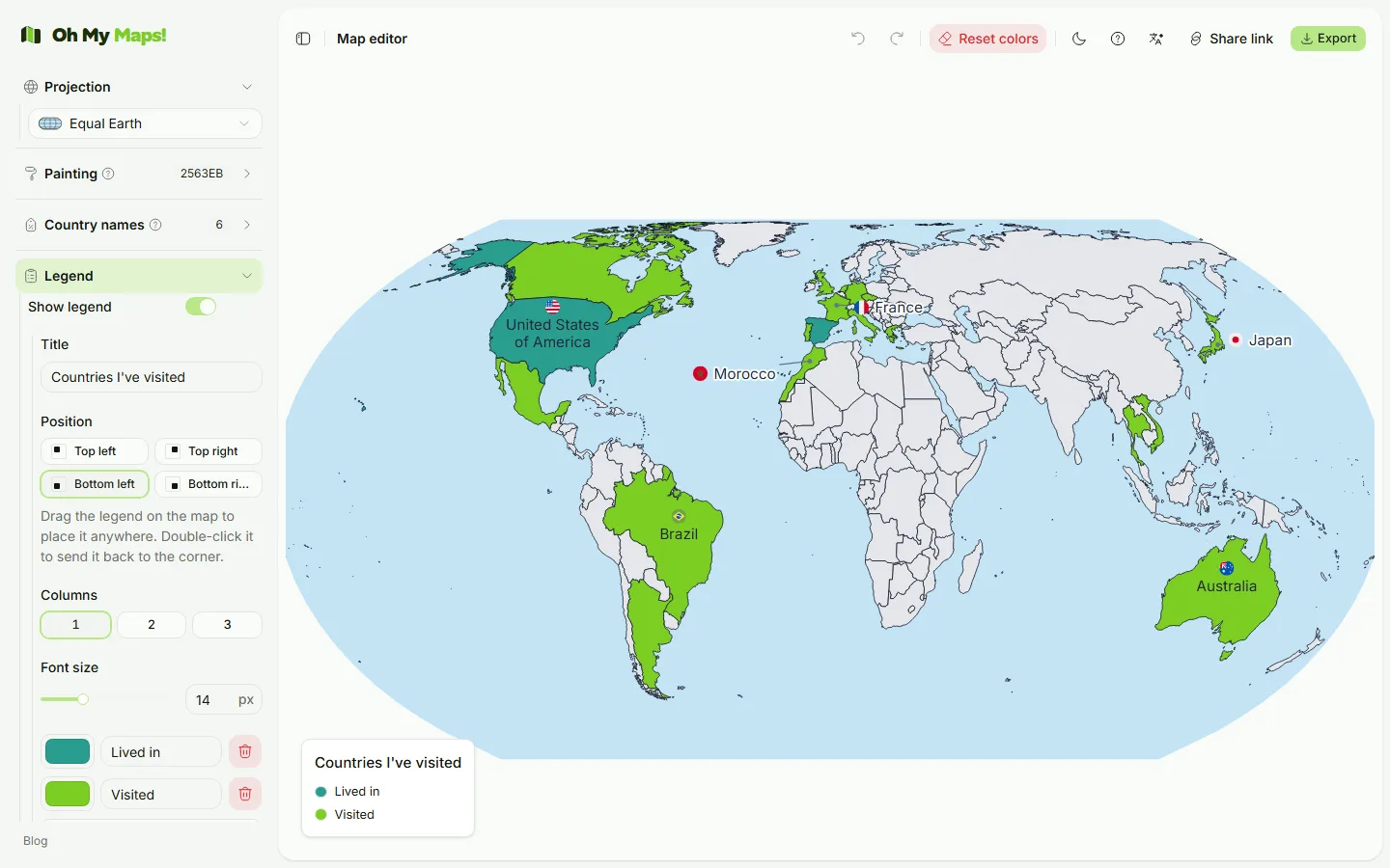
Put it in whichever of the four corners is emptiest: bottom-left is the usual answer for a world map, because the bottom-right corner has Australia and New Zealand in it. Nudge the legend font size until it is readable at the size you will actually publish.
If you want a heading baked into the image rather than added in a slide, use Title and Subtitle.
Label the ones you want to talk about
You almost certainly do not want all 235 names. Turn on country names and search for the handful that matter: the trip you are actually telling a story about. When a name is too big for its country, the label moves into a callout box beside it with a short leader line, which keeps small European countries readable instead of writing across three neighbours.
Flags beside the names are a nice touch on a travel map specifically; they come in circular or rectangular styles and are drawn into the exported file, not just the screen.
Choose the frame
For a visited-countries map, the projection choice is mostly aesthetic, but two notes:
- Natural Earth (the default) keeps areas close to reality. Your ten countries in Africa will not look smaller than two in Scandinavia.
- Mercator inflates everything far from the equator. A map of European travel looks impressive on Mercator for reasons that have nothing to do with where you went. It also excludes Antarctica by necessity.
- The orthographic globe is a great option if your travel clusters on one hemisphere: rotate it by dragging so the region you care about faces the viewer.
More detail in Which map projection should you use?.
Export or share
Export as PNG at 4000 px for a slide or a social post, or at 8000 px if you are printing it. Choose SVG if you want to keep editing it in Illustrator, Inkscape or Figma later. There is no watermark on any of them.
Two other ways out:
- Share copies a link that contains the whole map compressed into the URL fragment. Whoever opens it sees your map, and nothing was stored on a server to make that work.
- Save writes a
.jsonfile you can reopen later: worth doing before a trip, so next year’s update is a matter of clicking the new countries.
Keeping it up to date
The map autosaves in your browser, so coming back to the same browser picks up
where you left off. That storage is per-browser and per-machine, though. If the
map matters, keep the .json file: reopening it restores the map exactly, and it
even lands as a single undoable step, so you can compare against whatever you had
open.
Want the full tour of the editor rather than just the travel-map path? Start with How to make a custom world map online.
Ready to make yours? Oh My Maps! is free, runs in the browser and needs no sign-up. Your map is saved locally as you work, and exports carry no watermark.
Open the editor