How to Make an Equal Earth Map Online (Free, No Sign-Up)
·4 min·View as Markdown
TagsEqual EarthWorld MapMap Projections
Written byJordan Hale — Writer, Oh My Maps!
Contents
The UN’s September 2026 resolution recommended equal-area projections for maps used in teaching, media and digital products. If you make those maps, the practical question is what it takes to actually produce one.
In Oh My Maps! it takes one click, and this walkthrough covers the whole thing: the data first, the projection second, then export. Nothing here needs an account and nothing gets uploaded, because the editor runs entirely in your browser.
Step 1: build the map before you touch the projection
Start in the default view and get your content in. This matters for a practical reason: switching projection later re-renders the same document, so anything you do now survives the switch. Working the other way round wastes no effort either, but it does mean you spend the whole build looking at edge shapes that will move.
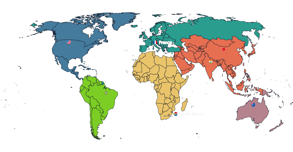
You have two ways in.
Paint by hand. Click a country to apply the current colour. Useful for categorical maps and for a quick comparison you want to make a point with.
Import a spreadsheet. Paste or drop a two-column table of region and value, and the editor matches the names and shades the map for you. This is the path for anything where the numbers are the story, and it is covered in depth in the choropleth guide.
For an equal-area map, the second path is the more likely one, because the whole reason to insist on exact area is that a reader is going to compare shaded regions.
Step 2: switch to Equal Earth
Open the Projection section in the sidebar and choose Equal Earth.
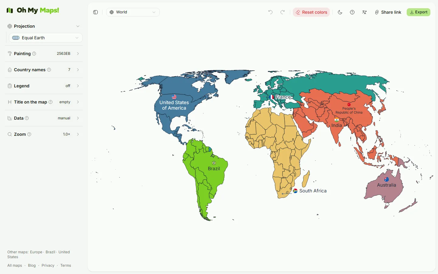
The map redraws immediately. Your painted countries, imported values, labels, legend and colours are all unchanged; only the geometry underneath them moves. Compare the two frames and you will see the shift straight away: the far north contracts, Africa and South America occupy more of the picture, and the outline gains Equal Earth’s rounded edges and pole lines.
If your audience needs the contrast made explicit, export once on Mercator and once on Equal Earth and put them side by side. That comparison is the argument the resolution is making, and it is more persuasive as two images than as a sentence.
Step 3: label what needs naming
Turn on labels for the regions you want named. Placement is automatic, so you are not dragging text boxes around, and the layout adapts to the projection you picked rather than being frozen from the previous one.
Keep this restrained on an equal-area map. Shape distortion near the edges means labels there are sitting on stretched landmasses, and a crowded rim is where an Equal Earth map looks worst.
Step 4: add a legend
If the map carries values, add the legend. It reads from the same bands your choropleth uses, so it cannot drift out of sync with the colours on the map, and it is included in the export.
Step 5: export
Export to SVG for anything going into print, a slide deck or further editing, since it stays sharp at any size. Export to PNG for the web and for social previews. The format trade-offs are laid out in the export guide.
Your work is saved in the browser as you go, and you can share the finished map as a link that carries the whole document in the URL, which is useful when a colleague needs to check the map rather than a picture of it.
A note on which equal-area projection
The resolution names Equal Earth, but it calls for equal-area projections generally. France complied by adopting Eckert IV instead, and Mollweide would answer it equally well. If your institution has a house standard, follow it. If it does not, Equal Earth is the reasonable default, because it is the one the text names and because it was designed specifically to look like a map people recognise rather than to win an argument about mathematics.
The reasoning behind that choice is in the Equal Earth explainer, and the question of whether your particular map should be equal-area at all is in equal-area vs compromise projections.
Make one now. Import your data, switch to Equal Earth, export it. No account, nothing uploaded.
Open the editorRelated reading: How to make a custom world map online and The true size of Africa.
Ready to make yours? Oh My Maps! is free, runs in the browser and needs no sign-up. Your map is saved locally as you work, and exports carry no watermark.
Open the editor